
What is the Midwest United States?
The midwestern United States, also referred to as Midwest, comprises one of the four census regions. In retrospect, it covers the northern central part of the United States. According to the Census Bureau's definition, 12 states are involved in the Midwest. The states are Illinois, Michigan. Indiana, Minnesota, Iowa, Kansas, Missouri, Nebraska, North Dakota, South Dakota, Ohio, and Wisconsin.
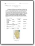
Illinois
Considered to be at the heart of the United States is the beautiful state of Illinois. The vast grasslands have turned this area into an agricultural center of farming. The state is bordered by both land and water. Glaciers that moved across the area during the last ice age helped mold the gently rolling plains and rich soil. As a result, three major land areas are currently in Illinois. They include the Central Plains, Shawnee Hills, and Gulf Coastal Plain. Cold winters and hot summers are part of the Illinois landscape. The state has many natural resources. Oil and coal are the most abundant and important.

Indiana
Indiana is primarily made up of lowlands, created by melting glaciers years ago. Indiana contains very fertile land, ideal for farming due to the rich, dark soil. Warm summers are characteristic of this region as well as cool winters. On occasion, a tornado may pass through the area and floods are an occasional natural event.
Iowa
Lovely rolling hills and sloping valleys are characteristic of Iowa. The beautiful prairie landscape is referred to as the Central Lowlands. Land excellent for farming abounds in Iowa. The Mississippi and Missouri Rivers are the largest rivers in the state and are among many rivers and streams that are present. An interesting fact about these two named rivers is that they define Iowa’s eastern and western borders!

Kansas
Flat beautiful prairies and snowcapped covered mountains describe some of the terrain in Kansas. A long time ago, the ocean covered what is now Kansas and as a result the earth is rich in limestone deposits throughout the area. Fossils have been discovered dating back millions of years. Warm summers and cold winters are usual for this state.
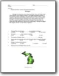
Michigan
Michigan is comprised of two major land areas. One is the Great Lakes Plain; the other is the Superior Uplands. The longest freshwater shoreline in the entire world exits in Michigan! The Great Lakes shoreline is about 10,500 miles long. About 20 percent of the earth’s fresh water supply is contained in Michigan.
East North Central United States
The North Central States of the United States are rich in many natural resources. For example, copper has been a resource mined in Michigan since the time of the First Nations, long before European arrival. The highest elevation in Michigan is Mt. Arvon, which stands at 1,979 feet!

Minnesota
Long ago, coniferous forests covered more than one third of what is the state of Minnesota! Large amounts of white pine were cut down and removed by the act of logging. Today, such trees as birch and poplar have been planted to replace much of this deforested land. Indigenous to Minnesota are eastern timber wolves and black bears.
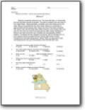
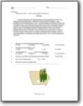
Missouri
Missouri sometimes referred to as “The Show Me State” is named after the river that flows through its borders. The state is located in the very heart of the United States. Many grainfields, cornfields, and cotton fields exist in the state. Missouri is bordered by five other states. Missouri is comprised of approximately 69,000 square miles.
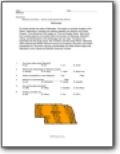
Nebraska
Six states border the state of Nebraska. The region is centrally located in the Nation. Nebraska is situated just halfway between the Atlantic and Pacific Oceans. The nickname of this region is "The Cornhusker State." More than two hundred airports are located within the borders of Nebraska. Beautiful, rolling, and fertile plains is the landscape one can view. T

North Dakota
Did you know that North Dakota was considered to be the driest state in the Nation? It's so! Low amounts of precipitation lead to this rating. The state also hosts long and bitter cold winters. Summers are often very hot.
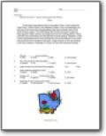
Ohio
Three major land regions exist in the state of Ohio. They include the Lake Plains, Central Plains, and Allegheny Plateau. Ohio has beautifully rich soil due to the many slow moving glaciers that once covered much of this North America region. The softly rolling hills of Ohio were also created by these glaciers. Many swamps and bogs exist from the melting glaciers. Warm summers and cold winters are characteristic of Ohio weather.
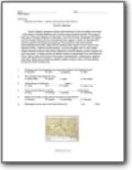
South Dakota
South Dakota' gorgeous Black Hills National Forest includes more than 1,300 miles of rolling streams and 10,000 acres of dense forest! This area is just one of the four regions of the state. The Drift Prairie, Dissected Till Plains, and the Great Plains are the remaining three regions. Much of this beautiful land is used for farmland and grazing.
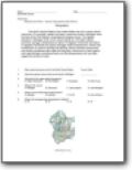
Wisconsin
Fox River, located in Wisconsin, is one of only a small number of rivers in the Nation that flows north, rather than south! Land regions in Wisconsin include the Superior Upland and Central Lowland. Summers are often hot, hot, and hot. Much of the state at one time was covered in forests. Deforestation has occurred, and today trees are imported and planted to replenish the areas.