
What is the South-Central United States?
The south-central united states are located in the south-central portion of the Southern US. It comprises eight states, namely Alabama, Mississippi, Kentucky, Tennessee, Oklahoma, Texas, Arkansas, and Louisiana.

Alabama
Alabama hosts both beautiful rolling hills as well as the Appalachian Mountains. A large river used as a source of energy runs through the state. This river is the Tennessee River. Most of Alabama is flat land used for farming. A small portion of the state's border runs along the Gulf of Mexico. Five regions exist in the state.

Arkansas
Arkansas can often be segmented into three triangular shapes! Lowlands cover the southern part of the state, low level plains blanket the southeastern part, and mountains tower above the northwestern highlands! The climate of Arkansas delivers long and very hot summers, while winters deliver short and very mild conditions.

East South Central
This region of the United States hosts many different landforms. Alabama, for example, is rich in natural resources such as coal, rich soil, and iron ore. Beautiful rivers provide water needed for recreation as well as irrigation. Low plateaus and mountains exist in this region. Climates vary from subtropical in Tennessee to long, warm summers of Alabama.

Kentucky
Gorgeous rolling plains and serrated hillsides are characteristic of Kentucky’s landforms. Flood plains in the western part of the state are where many birds of various species migrate annually. The state is entirely enclosed within the drainage basin of the Mississippi River.
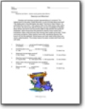
Louisiana
Swamps and marshes are best representative of Louisiana! The highest point in the state, Driskill Mountain, is only 535 feet above sea level! The lowest point is five feet below sea level! This local is New Orleans. It's estimated that more than 7,400 square miles of the state exists under water! As a result, the land is just right for farming, yet very susceptible to flooding.

Oklahoma
Beautiful and fertile farmland and mountain ranges blanket much of the state of Oklahoma. Elevations above sea level range from 300 feet to over 5,000 feet! Spring like temperatures deliver comfortable climate in the southern region of the state yet in the Panhandle, up to about twelve inches of snow may fall!
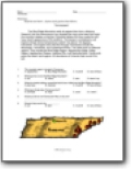
Tennessee
The Blue Ridge Mountains really do appear blue from a distance. Research into this phenomenon has revealed the many pine trees that forest the mountain release a chemical. Scientists believe this may create the soft hazy, bluish appearance of this landform. Tennessee is considered a sub tropical climate where temperatures seldom rise above 100 degrees Fahrenheit.

Texas
Four major land parts make up the state of Texas! The Coastal Plain covers more than 40 percent of the state. This region includes beaches and coastline. Warm and dry summers are delivered in the Central Lowlands. Flat and barren land describes the land in the Great Plains area.

West South Central
Three triangular shapes often resemble the state of Arkansas! Long, hot summers represent this state, while winters are mild and short. Louisiana is made up mainly of swamps and marshes. Many rivers exist in this state. These rivers are often very slow moving and small and sometimes branch off into wetlands. They can be comprised of both fresh and salt water and are called bayous. If bayous contain saltwater, it is called brackish.